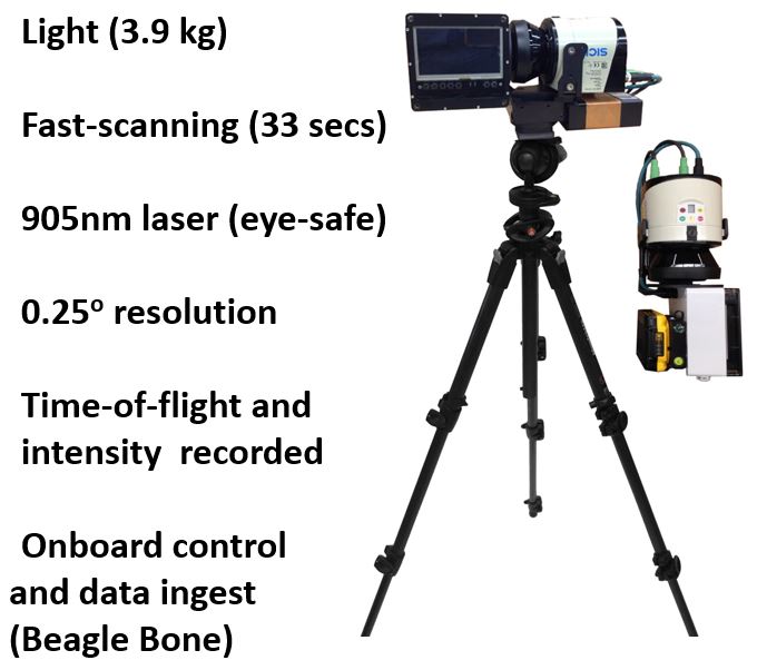
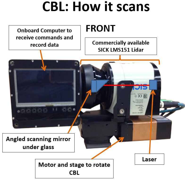
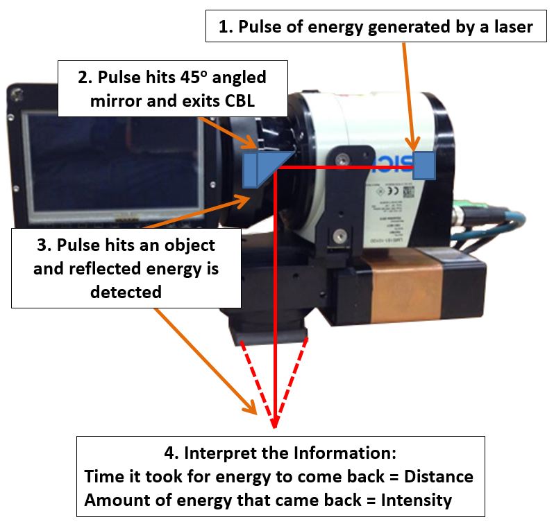
CBL
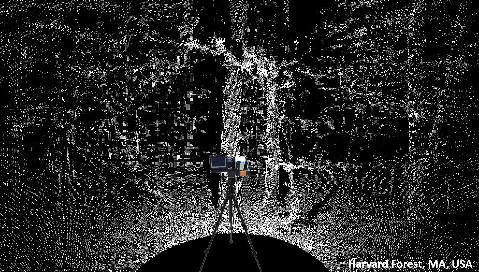
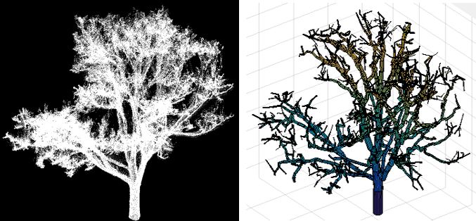
We use the unique portability and robustness of the CBL to scan many different types of environments, and use the structural information in lots of different ways. For example we scan forests to look at the size, structure and biomass of the trees:
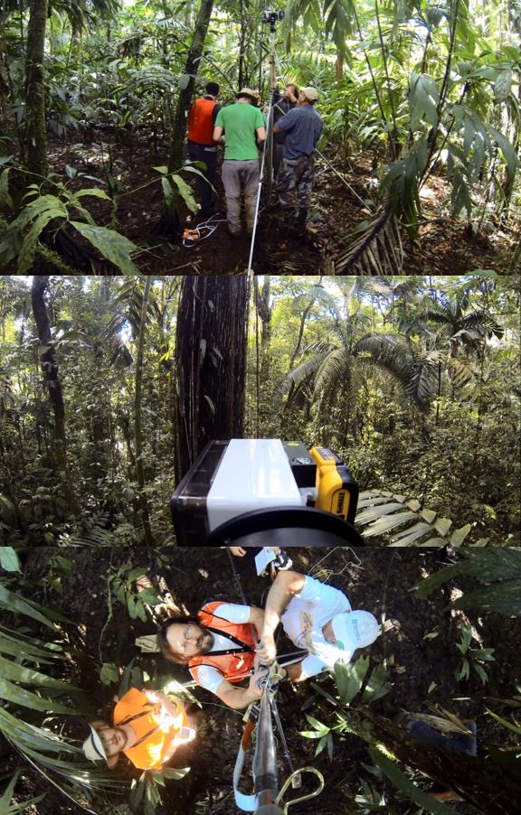
We work extensively in tropical forests. The light CBL can be deployed on large tripods to reach areas which are hard to observe, such as the upper canopies of tropical forests. CBL Engineer Francesco Peri appears in the center-left of the bottom image:
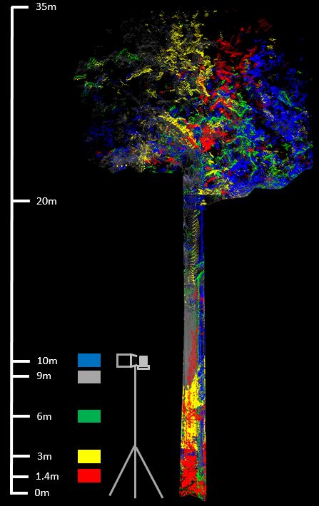
By combining multiple scans we can look at the structure of even very tall tropical trees:
We have also studied mangroves in Costa Rica at part of a NASA EcoSAR validation campaign:
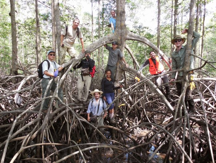
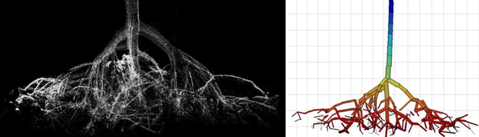
The roots of the mangroves are modelled similarly to tree branches:
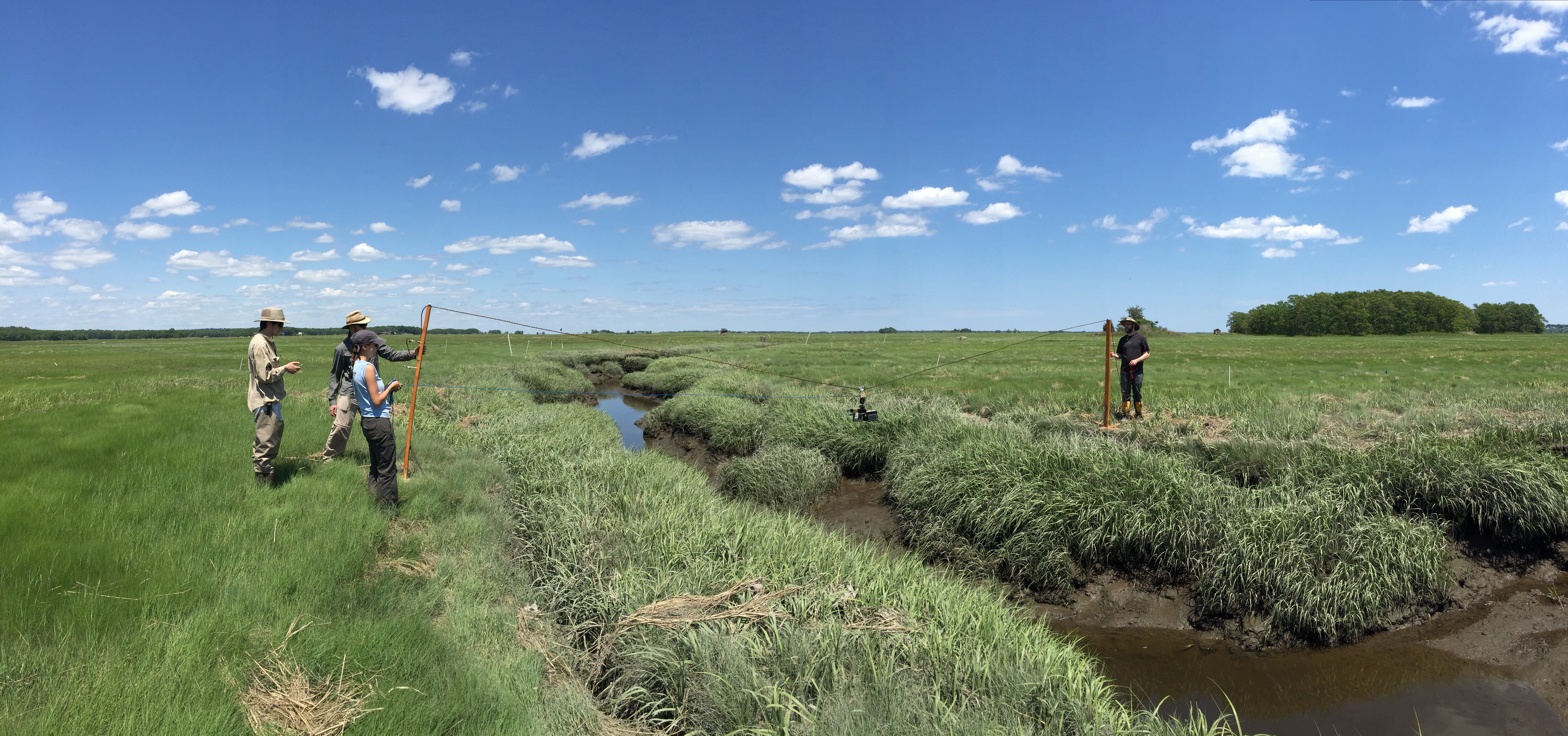
We have also studied vegetation dynamics and geomorphology at Plum Island LTER in collaboration with the TIDE project. These deployment towers facilitated scanning of the creeks while minimizing disturbance:
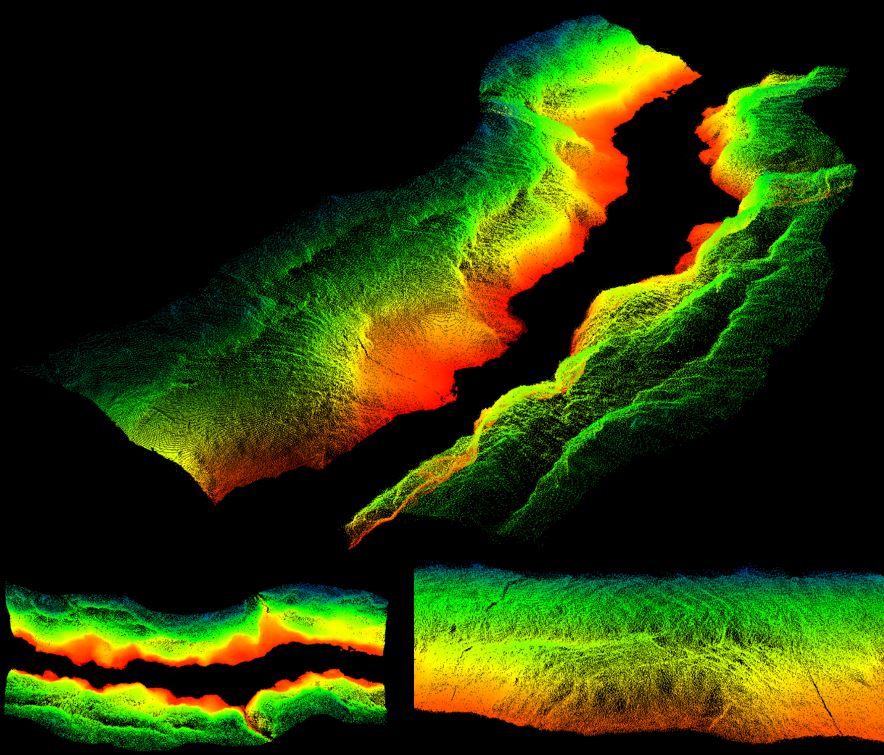
This is a lidar "point cloud" of the structure of the creeks:
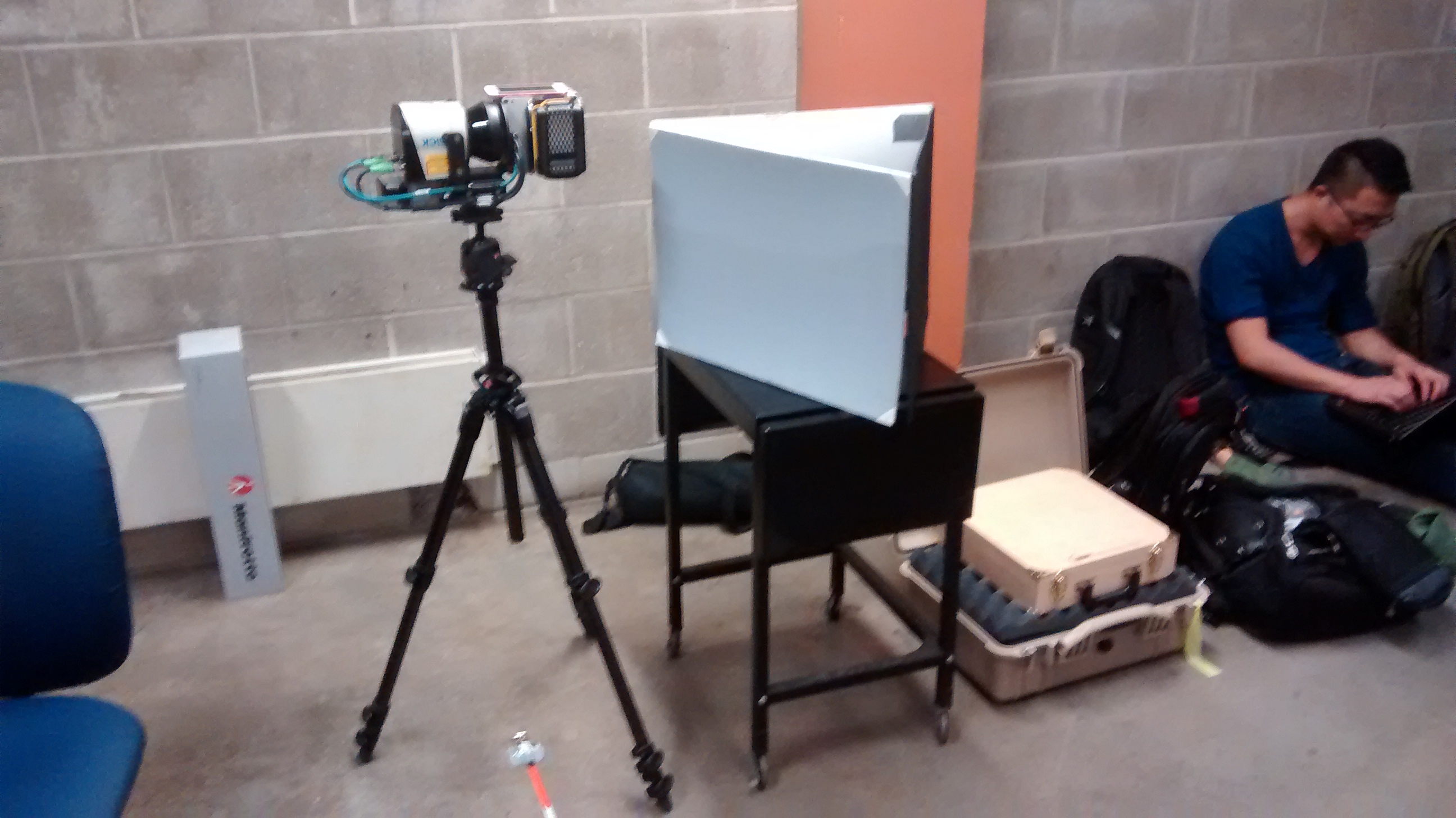
We extensively calibrate our instruments at UMass Boston:
Professor Crystal Schaaf’s Lab
University of Massachusetts Boston
100 Morrissey Blvd.
Boston, MA 02125