Approach and Data Flow
How the Concurrent Approach Works
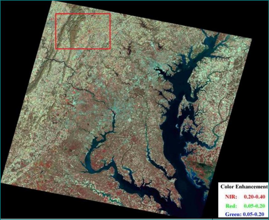
Land surface 30-m white-sky albedo composite (NIR, Red, and green bands to RGB channel) 19 March 2001
Methods
Landsat satellites do not directly capture the intrinsic anisotropy of non-lambertian surfaces and therefore cannot directly ascertain true hemispherical surface albedo. This research team has recently developed a method for direct calculation of 30-meter albedo from Landsat by fusing Landsat atmospherically corrected surface reflectance with the MODIS BRDF information derived from multi-angle information (Shuai et al., 2011). The “concurrent approach” developed by our team relies on using simultaneous Landsat reflectance observations and MODIS surface anisotropy (BRDF model) results from the 2000-present period (see flow chart below).
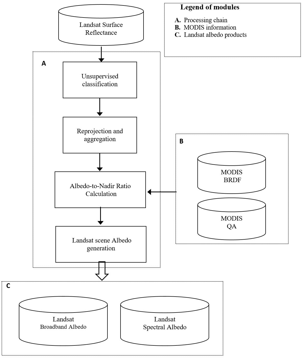
In order to associate MODIS BRDF anisotropy information with the Landsat 30m pixels, it is necessary to identify the predominant cover types in order to identify a “pure patch” for each cover in the concurrent MODIS acquisition, that is, MODIS pixels that are homogenous over the underlying Landsat resolution. Therefore an unsupervised cluster-based classification of the spectral signatures is run on the input multiband Landsat image to establish the land covers. Ten to fifteen final classes are identified using the spectral signatures of the six non-thermal Landsat bands in each scene. Landsat data are first reprojected from UTM to MODIS sinusoidal (SIN) projection, then aggregated from 30-m to 500-m, and then the proportion of classes within each MODIS pixel is calculated. The modal class ID and its percentage are calculated, and MODIS pixels with a modal class percentage over a given threshold are marked as relatively “pure” pixels. MODIS pixels with the top 15% of each majority class are used as representative pixels in the following case study. Classes that have no “pure” pixel examples are flagged.
Next, the highest quality snow-free MODIS BRDF parameters for these available “pure” pixels are extracted from the concurrent MCD43A1 BRDF product, where the quality is assessed using the MCD43A2 QA (Quality Assessment) layer (Schaaf et al., 2002; 2011; Shuai et al., 2008). These are used to calculate the spectral Albedo-to-Nadir Reflectance (AN) ratios. The spectral nadir reflectance, white-sky albedo, and black-sky albedo at MODIS scale for the “pure” pixels are calculated under the solar geometry at Landsat overpass time using the related BRDF parameters. The spectral AN ratios then are computed for white-sky albedo and black-sky albedo.
.jpeg)
Maryland, DC, eastern Virginia, 19 March 2001 from the modified unsupervised classifier with a 30m classification map (left) in UTM, a majority class map (upper right) and percentage map related to the aggregated majority class (lower right) at MODIS 500-m scale in SIN projection (Shuai et al., 2011).
Finally, these class-specific spectral AN ratios are applied to each pixel in the Landsat surface reflectance image to generate the spectral Landsat white-sky and black-sky albedo under the solar zenith angle at Landsat overpass time ( see title figure). The Landsat broadband albedos at visible (0.4-0.7μm), near infrared (0.7-2.5μm), and shortwave (0.25-2.5μm) bands are produced by a further narrow-to-broadband conversion based on extensive radiative transfer simulations (Liang, 1999;2000).
Current Status:
The current scope of this project is to create a MODIS era Landsat albedo archive of North America. .Pre-MODIS era Landsat Albedo product is under development. For data from regions outside of North America and for more information please contact Professor Crysta Schaaf for more information:
Dr. Crystal Schaaf
Crystal.Schaaf@umb.edu
Professor of Remote Sensing/GIS, School for the Environment
References
Professor Crystal Schaaf’s Lab
University of Massachusetts Boston
100 Morrissey Blvd.