UAV Coastal Geomorphology Research – Samantha McFarland
UAVs bring to the table an unprecedented level of accuracy and are highly deployable, cost-effective, useful tools for monitoring coastal systems on a variety of spatial and temporal scales. This makes them particularly well suited to observe responses of the coastal system to both seasonal and storm-related events.
In early December 2017, an overwash event occurred between Herring Cove Beach and Woodsend in the Cape Cod National Seashore. This same area had previously experienced a breach in the 1990s.
A series of Nor’easters have continued to affect the area. On March 1, 2018, a field team surveyed the area using a Phantom 4 UAV. The mapped area included 175 acres of beach and the back barrier environment. We continue to monitor the area with an R8 Trimble unit after each Nor’easter and plan to re-survey the area using the UAV very soon.
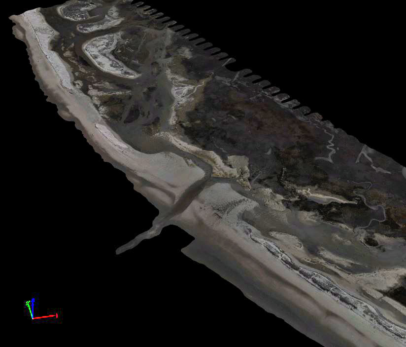
Surveying the area with the UAV allows us to create 3D surface models with centimeter scale accuracy. Pictured below is a portion of the area mapped on March 1, 2018. This 3D surface model represents the area one day before the large March 2, 2018 Nor’easter. It will be compared to surfaces created from ongoing data collection to look at changes caused by these storm events.
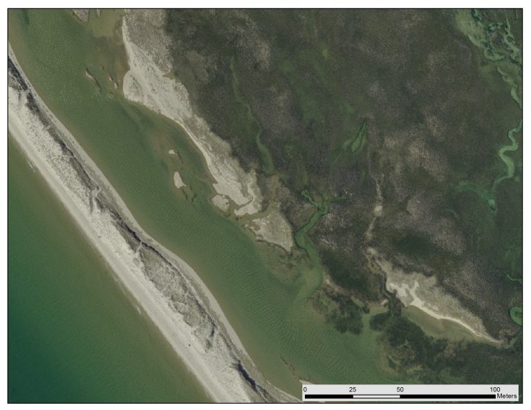
This image is a 30 cm resolution orthomosaic from 2014 (MassGIS).
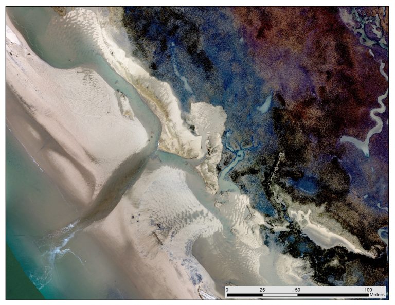
This next image is a 2 cm resolution orthomosaic taken on March 1, 2018 with the CaPE Lab's Phantom 4 UAV.